Start with the trip
Days, base location, transport, pace, children or older travelers, and any must-see places set the first plan.
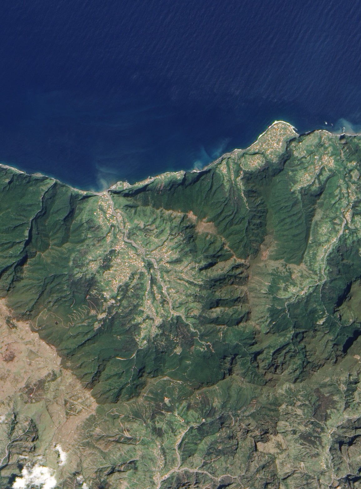
32°44'N · 16°57'W
Curated routes, weather-aware plans, and quiet local detail for days on the island.
Satellite image: NASA Earth Observatory
A field guide, not a list
Madeira Unfolded starts from the way a day actually feels: where you stay, how you move, who travels with you, what the weather allows, and which places are worth protecting in the plan.
The app favors fewer, better choices. Every stop needs a reason, a practical note, and a graceful plan B when the island changes its mind.
Adaptive itinerary
Day 2 · Lower and calmer
Days, base location, transport, pace, children or older travelers, and any must-see places set the first plan.
Move toward lighter days, more levadas, more local stops, or shorter drives without rebuilding everything by hand.
Weather, trail state, parking, exposure, and time of day can change what belongs in the plan.
Coded phone mockups
The full app mockup keeps the designer's phone treatment as live HTML and CSS: editorial copy, accent words, weather-aware states, and the same warm-paper rhythm.
Open full previewOld town lanes, the cable car up to Monte, a first poncha at dusk.
Ponta de São Lourenço before the heat, lunch in Caniçal, slow afternoon.
Caldeirão Verde through the laurisilva, then Santana before the light goes.
Day map
The map is the main travel surface: days, places, field notes, route status, media, and navigation handoff live in one calm view.
Keep forest walks flexible.
Remove it from today.
Stay near bus links.
Optional help
Request a guide when a route needs context, confidence, or a slower pace.
Arrange a short session around the right light and a route that still makes sense.
Use transport when public links are thin or a point-to-point walk needs a clean finish.
Early access
The first release is Android-first, with macOS used for development and debugging. The product is being built around curated content, not scraped volume.